AGU Conference 2024
Media Workshop
Monday, December 9
3:30pm ET

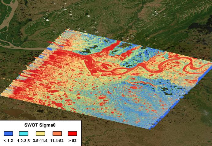
In a hands-on session, researchers from NASA’s Jet Propulsion Laboratory, the U.S. Geological Survey (USGS), and Ohio State University will walk reporters through two new freshwater data dashboards from the Surface Water and Ocean Topography (SWOT) mission.
Water is life, but we have reliable water level measurements for only a few thousand lakes around the world, and little to no data on some of the planet’s important river systems. The international SWOT satellite is filling in that enormous gap.
The two new data dashboards will make it easier to access SWOT’s data on freshwater levels around the world on a roughly 1.5- to 2-week timescale. Hosted by the Consortium of Universities for the Advancement of Hydrologic Science, one dashboard contains global river data from SWOT. The other dashboard, hosted by USGS, focuses on rivers and lakes in the United States. The USGS dashboard also includes the agency’s streamflow measurements taken by on-the-ground sensors.
Panelist Information
- Angelica Rodriguez, NASA’s Jet Propulsion Laboratory
- Merritt Harlan, United States Geological Survey
- Michael Durand, Ohio State University
Freshwater Data Dashboards
SWOTViz
Global river data based on information from the international SWOT satellite.
Water Information from Space (WISP)
Dashboard focused on the U.S. that contains satellite data from SWOT as well as gage measurements from the U.S. Geological Survey.
Media Contacts
Jane J. Lee / Andrew Wang
Jet Propulsion Laboratory, Pasadena, Calif.
626-491-1943 / 626-379-6874
