NASA
Jet Propulsion Laboratory California Institute of Technology
Skip Navigation
NASA SWOT
Follow JPL
menu close modal

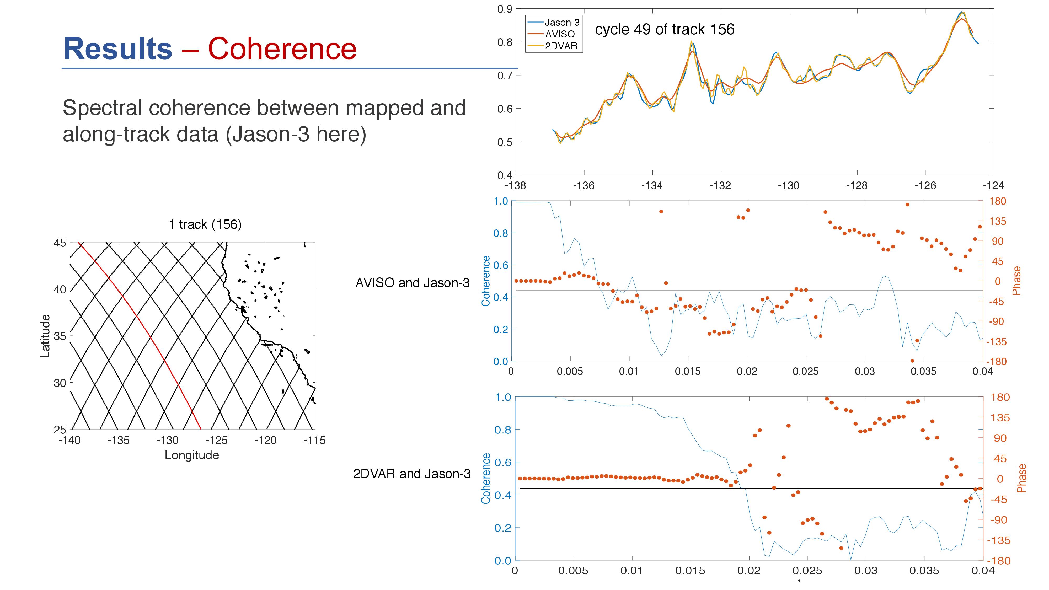
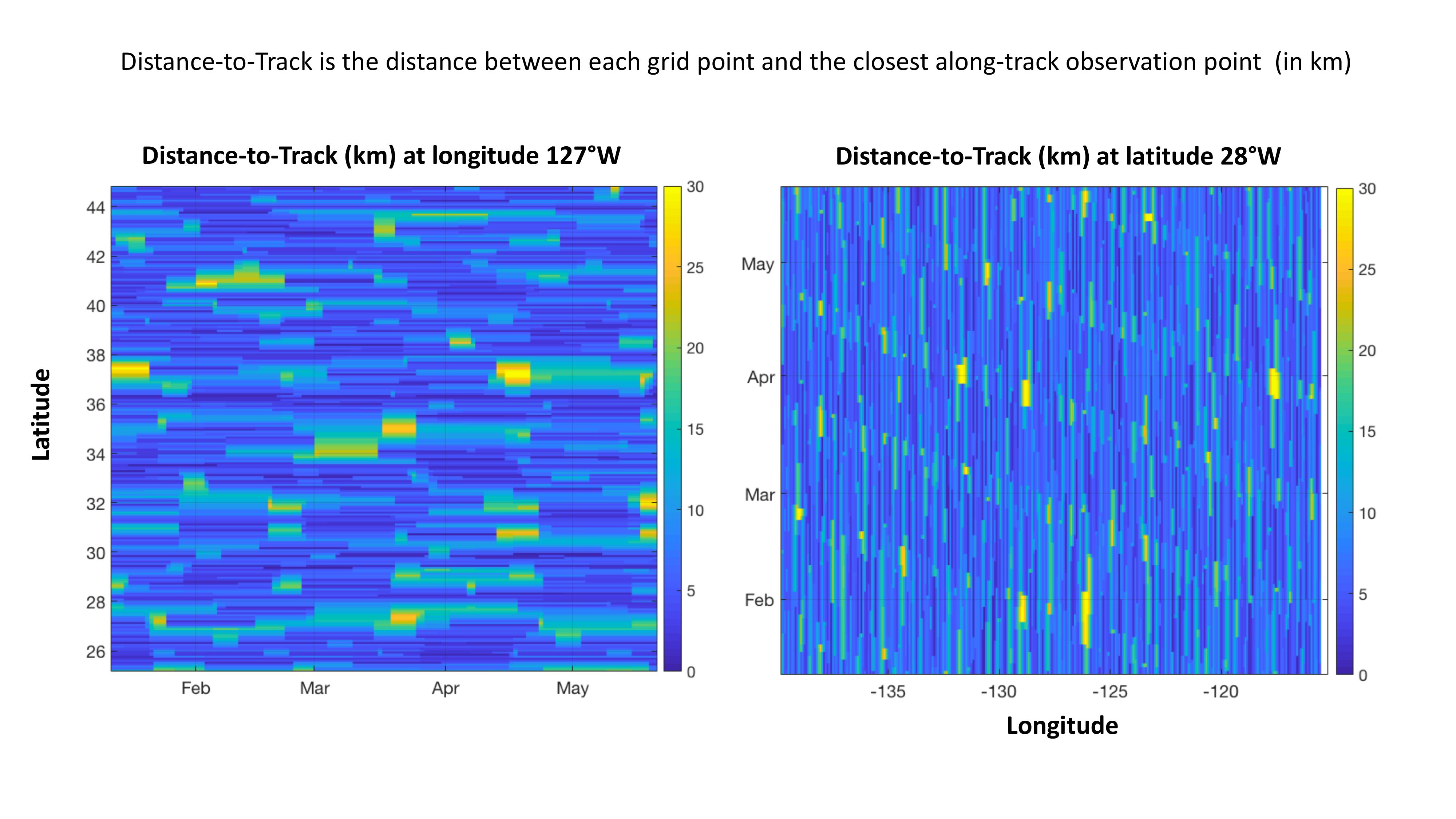
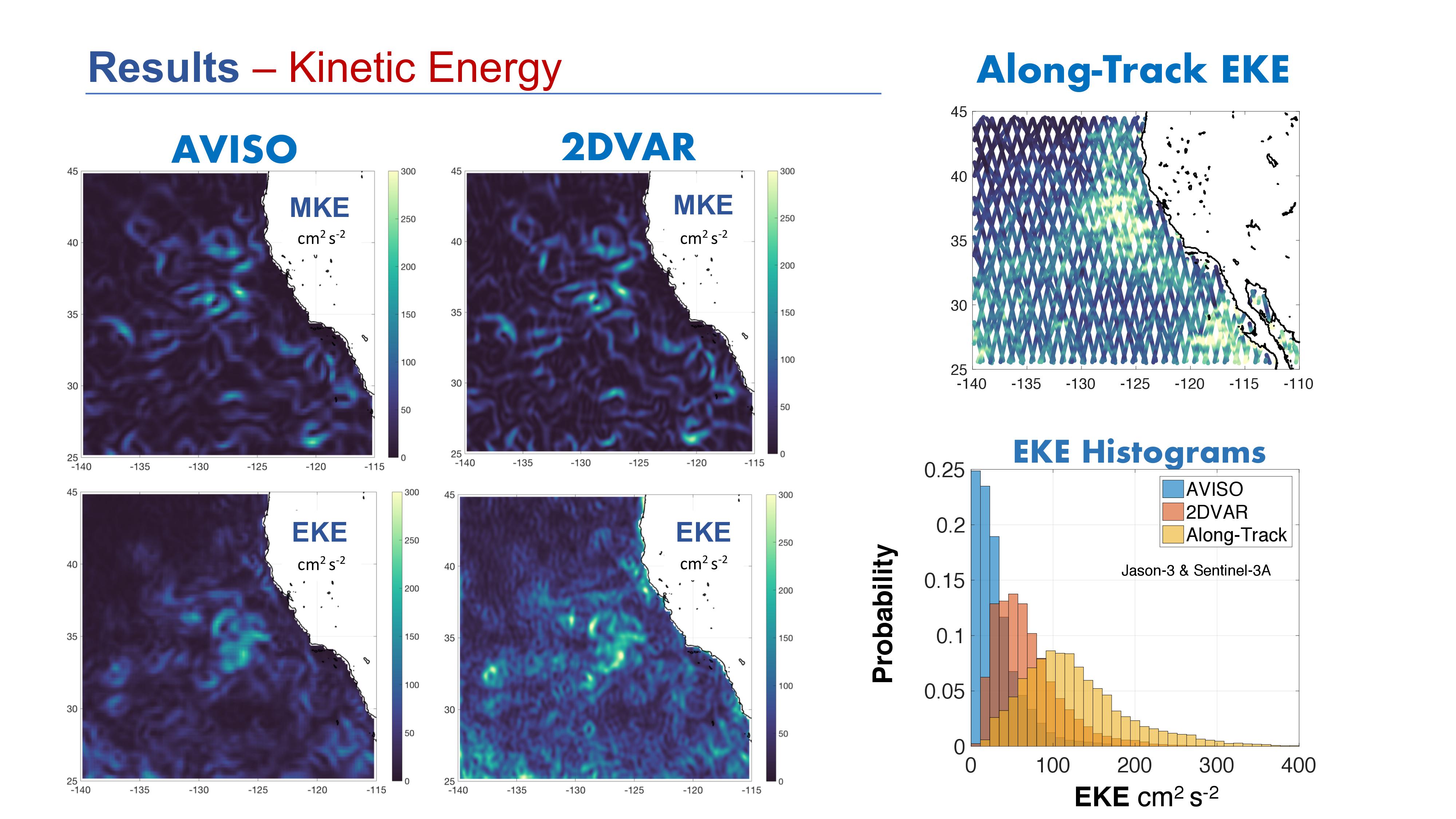
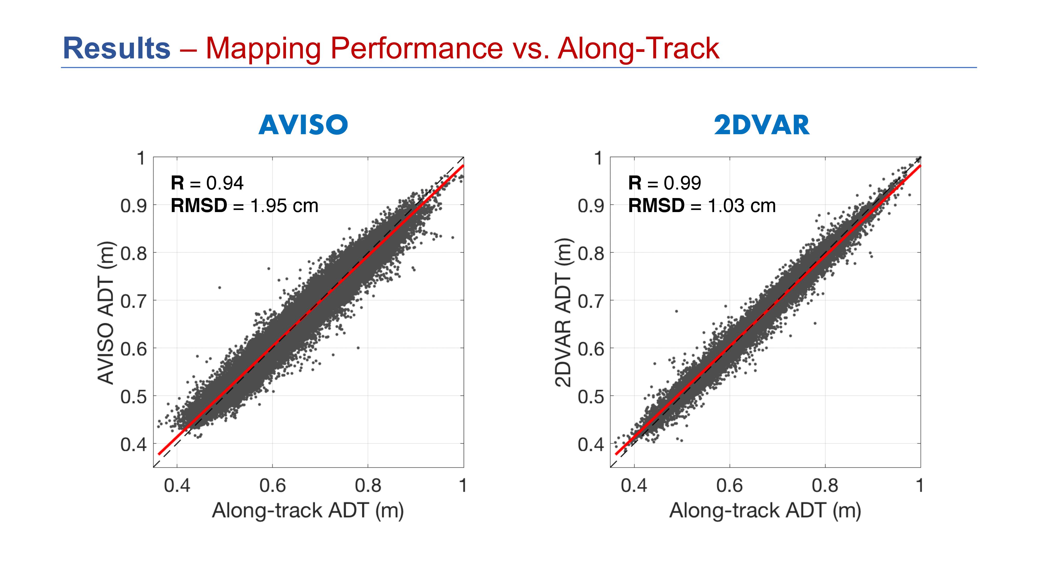
Documents

Increasing the Resolution of Mapped Sea Surface Height in the California Current System

Lee-Lueng Fu (20-Jun-19)

Click on any item to begin slideshow.

  • Increasing the Resolution of Mapped Sea Surface Height in the California Current System - Slide #1
  • Increasing the Resolution of Mapped Sea Surface Height in the California Current System - Slide #2
  • Increasing the Resolution of Mapped Sea Surface Height in the California Current System - Slide #3
  • Increasing the Resolution of Mapped Sea Surface Height in the California Current System - Slide #4
  • Increasing the Resolution of Mapped Sea Surface Height in the California Current System - Slide #5
  • Increasing the Resolution of Mapped Sea Surface Height in the California Current System - Slide #6
  • Increasing the Resolution of Mapped Sea Surface Height in the California Current System - Slide #7
  • Increasing the Resolution of Mapped Sea Surface Height in the California Current System - Slide #8
  • Increasing the Resolution of Mapped Sea Surface Height in the California Current System - Slide #9
  • Increasing the Resolution of Mapped Sea Surface Height in the California Current System - Slide #10
  • Increasing the Resolution of Mapped Sea Surface Height in the California Current System - Slide #11
  • Increasing the Resolution of Mapped Sea Surface Height in the California Current System - Slide #12
  • Increasing the Resolution of Mapped Sea Surface Height in the California Current System - Slide #13
  • Increasing the Resolution of Mapped Sea Surface Height in the California Current System - Slide #14
  • Increasing the Resolution of Mapped Sea Surface Height in the California Current System - Slide #15
  • Increasing the Resolution of Mapped Sea Surface Height in the California Current System - Slide #16
  • Increasing the Resolution of Mapped Sea Surface Height in the California Current System - Slide #17
  • Increasing the Resolution of Mapped Sea Surface Height in the California Current System - Slide #18
  • Increasing the Resolution of Mapped Sea Surface Height in the California Current System - Slide #19
  • Increasing the Resolution of Mapped Sea Surface Height in the California Current System - Slide #20
  • Increasing the Resolution of Mapped Sea Surface Height in the California Current System - Slide #21
  • Increasing the Resolution of Mapped Sea Surface Height in the California Current System - Slide #22
  • Increasing the Resolution of Mapped Sea Surface Height in the California Current System - Slide #23
  • Increasing the Resolution of Mapped Sea Surface Height in the California Current System - Slide #24
  • Increasing the Resolution of Mapped Sea Surface Height in the California Current System - Slide #25
  • Increasing the Resolution of Mapped Sea Surface Height in the California Current System - Slide #26

Get the Newsletter

Follow JPL

Home

Mission

    • Overview
    • Launch
    • Flight Systems
    • Ground Systems & Data
    • AirSWOT
    • SWOT in Space and Time
    • Mission People

Science

    • Overview
    • Oceanography
    • Hydrology
    • Science Team Projects
    • Publications

Applications

    • Overview
    • Applications Areas
    • Early Adopters
    • Newsletter

Data

News & Events

    • News
    • Meetings

Resources

    • Multimedia
    • Documents
    • Press Kit
    • Directory
    • Where's Water? Quiz
    • Website Guide
  • Feedback
  • |
  • NASA
  • |
  • CALTECH
  • |
  • Privacy
  • |
  • Image Policy
  • |
  • FAQ
  • |
  • Acrobat Reader
  • |
  • Accessibility

NASA Official: Angelica Rodriguez