Projects
Global tracking of freshwater discharge from melting ice and snow
Principle Investigator: Laurence Smith (Brown University)
Co-Investigator(s): Cassie Stuurman, Megan Garner, James Leach
This project will assess the importance of melting ice and snow on downstream freshwater resources. The study is global in scope, with an initial review of 78 critical "Water Tower Units" (WTUs) upon which nearly 2 billion people depend (Immerzeel et al., Nature, 2020). A subset of ~10 WTUs will be identified for comprehensive study.
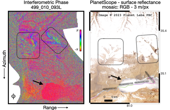
As a hydrological mission, SWOT is uniquely poised to track freshwater discharge released from melting ice and snow and -- very likely -- their melting surface elevations as well. SWOT is amassing measurements of water surface elevation (WSE), slope (WSS), discharge, and extent in lakes, reservoirs, and rivers from the world's WTUs. Exciting early findings prepared for this proposal indicate that SWOT can retrieve elevations and extents from their melting ice and snow surfaces as well. This signifies a powerful new opportunity to pair SWOT observations of melting source areas with associated downstream river discharges, lake/reservoir volumes, and societal resilience -- a unique capability not available from other satellite platforms.
By characterizing SWOT Ka-band backscatter, coherence, and elevation retrievals over ice and snow we will also improve understanding of their impact on standard SWOT hydrology products. The mission's current "ice" flag, for example, relies on long-term climatology or asynchronous optical images. While less of an issue in the Arctic and other reliably frozen landscapes, accurate ice-flagging is a serious problem for SWOT data products in more populous, seasonally cold regions where rivers are intermittently impacted by ice and snow throughout the winter.
The proposed research is driven by four science questions:
- What are the spatially disaggregated fluxes, storages, and seasonal variability in freshwater resources within critical WTUs?
- How important is meltwater to freshwater resource stability and societal resilience downstream?
- What are the characteristics of SWOT near-nadir Ka-band backscatter, phase coherence, and surface elevation retrievals over melting ice and snow?
- How do freezing, icings, and snow accumulation impact SWOT hydrology products?
To answer these questions we propose to: 1) identify ~10 WTUs optimal for detailed SWOT study (viewing geometries; abundant rivers, lakes and reservoirs; minimal layover; coherent returns); 2) Obtain spatially disaggregated fluxes, storages, and timings of freshwater throughout these WTUs from SWOT WSE, WSS, extent, and discharge observations; 3) Characterize SWOT backscatter, coherence, and elevation retrievals from snow/ice within the selected WTUs; 4) Verify interpretations with in situ datasets of discharge, WSE, and snow/ice properties; and 5) Assess downstream freshwater resource stability and societal resilience using SWOT observations, ERA-5 and MERRA-2 global climate reanalysis, and a simple meltwater security index. Throughout the project, our work will test three scientific hypotheses. The research team is qualified and experienced and offers a strong partnership with the Water Survey of Canada at no cost.


