Projects
Global Marine Gravity, Bathymetry, and Small-scale Ocean Interactions from SWOT
Principle Investigator: David Sandwell (Scripps Institution of Oceanography)
Collaborator(s): Yao Yu, Josephine Joergensen, Ole Andersen
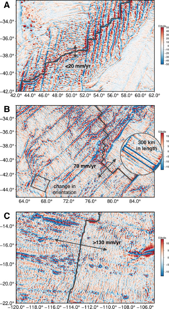
One of the secondary objectives of the SWOT mission is marine geophysics. The focus of our proposal is on the time invariant part of the sea surface height to measure the marine gravity field and use these new data to map the 75% of the seafloor that has not been explored by ships. Our initial analysis of the SWOT data shows much higher accuracy and resolution than anticipated. This is resulting in extraordinary scientific discoveries in geophysics, ocean dynamics, climate, and biological oceanography. These improvements are critical for many basic science and practical applications, including:
- Understanding the geologic processes responsible for ocean floor features unexplained by simple plate tectonics, such as abyssal hills, seamounts, microplates, and propagating rifts.
- improving tsunami hazard forecast accuracy by mapping the deep ocean topography that steers tsunami wave energy.
- Determining the effects of bathymetry and seafloor roughness on ocean circulation, mixing, climate, and biological communities, habitats, and mobility.
- Mapping the marine gravity field to improve inertial navigation and provide homogeneous coverage of continental margins.
- Providing bathymetric maps for numerous other practical applications, including reconnaissance for submarine cable and pipeline routes, improving tide models, and assessing potential territorial claims to the seabed under the United Nations Convention on the Law of the Sea. Because ocean bathymetry is a fundamental measurement of our planet, there is a broad spectrum of interest from government, the research community, industry, and the public (e.g., Google Earth).

