Documents
SWOT Promises in River Deltas and Esturies
Principle Investigator: Marc Simard (Jet Propulsion Laboratory)
Co-Investigator(s): Pascal Matte, Alexandra Christensen, Michael Denbina
Collaborator(s): Benoit Laignel, Paul Bell, Paul Bates, Emmanuel Mambela, Nicaise Rabenkogo
Coastal wetlands support a wide range of plant, mammal, bird, fish and crustacean species and act as a natural buffer against flooding. These wetlands, which include marshes and mangroves, are nourished by river deltas and estuaries and play a significant role in the carbon cycle. However, these ecosystems and the services they provide, are threatened by the impacts of climate change, which is exacerbated by human activity. Understanding hydrodynamic processes is key to determining their resilience to environmental changes. SWOT offers a compelling solution, with water surface elevation (WSE) measurements across estuaries and river deltas worldwide.
To achieve that, we evaluate the uncertainty of SWOT's WSE measurements in coastal environments and develop new methods to improve the measurements across the land-ocean-aquatic continuum. Using SWOT measurements collected over years, we reconstruct hourly tides to better calibrating and validate hydrodynamic models. These models will be used to assess the vulnerability of coastal wetlands and estimate how much carbon is exported to ocean.
Our international team of researchers from USA, France, Canada, UK and Gabon has the necessary expertise to address these challenges and has executed in situ and airborne campaign experiments in their respective countries. We develop our approaches using in situ, airborne and SWOT data in 5 primary sites (the St-Lawrence and Saguenay estuaries in Québec, the Komo estuary in Gabon, the Severn Estuary in the UK and the Mississippi River Delta in Louisiana) before they are applied to a global set of 50 river deltas and 4 estuaries.
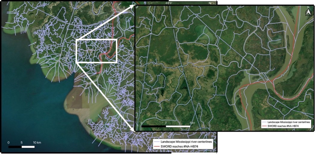
To understand the sources of error, we characterize SWOT’s capabilities as a function of water surface conditions (e.g. wave height, orientation, currents and ice cover) and to the landscape's complexity (i.e. varying channel network width and density, and vegetation extent and structure). We create two novel coast-specific map products to preserve the details of these complex coastal landscapes: an irregular hydro-geomorphic grid and a channel network. Both are used to aggregate fine scale SWOT measurements and error estimates. Then, we generate a new global hourly tide reconstruction product using a non-stationary harmonic analysis of the channel network nodes. This is essentially fitting a function to SWOT’s sparse—i.e. 2 to 4 times every 21 days— measurements. Finally, we demonstrate how to derive hydrodynamic quantities such as tidal range and hydroperiod (i.e. time plants stay below water), which are vital parameters for marsh productivity and resilience.

