Overview
SWOT will provide the very first comprehensive view of Earth's freshwater bodies from space and will allow scientists to determine changing volumes of fresh water across the globe at an unprecedented resolution. Hydrologists will use the data to calculate the rate of water gained or lost in lakes, reservoirs, and wetlands as well as discharge variations in rivers, globally. These measurements are key to understanding surface water availability and in preparing for important water-related hazards such as floods and droughts.
Assessing Fresh Water Availability
Improving Hydrological Models
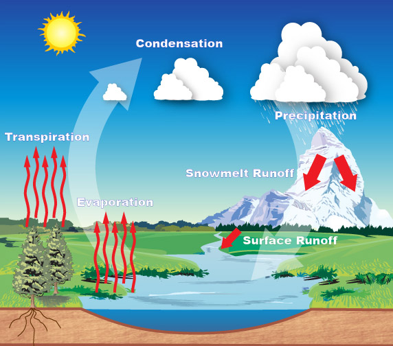
On land, most water accessible to humans is stored in lakes, rivers, and soil and groundwater. Water enters these reservoirs through precipitation (rain, snow) and flow from their surrounding watersheds. Water leaves via evaporation, transpiration (evaporation through plant leaves) and river discharge into the ocean. A simplified view of the water cycle shows a balance between water entering the land surface by precipitation and water leaving the land surface by evaporation, transpiration, and runoff.
This type of "balance equation" serves as the basis for computer algorithms used to model hydrological conditions. The most sophisticated computer models include data assimilation, a process that continually compares previous forecasts with newly received measurements (e.g., actual rainfall data) to update and improve the model itself. A challenge for SWOT is developing robust global hydrological models and assessing how assimilation of SWOT data will improve representation of the water cycle. For example, the current understanding of Earth's water balance on land is poor. This is partly because of a lack of global runoff data needed for accurate computer models. Today's models can simulate very different patterns of runoff, as shown by the two example computer model outputs below. For the areas circled in white, the difference in these models is equivalent to the average rainfall in Los Angeles over an entire year. A key target for SWOT is providing runoff data at sufficiently fine spatial scales to improve the knowledge of water balance on land.

Hydrology Science Investigations