NEWS | December 9, 2022
Water-Tracking SWOT Satellite Encapsulated in Rocket Payload Fairing
The international Surface Water and Ocean Topography mission is one step closer to launching so it can track water on more than 90% of Earth’s surface.
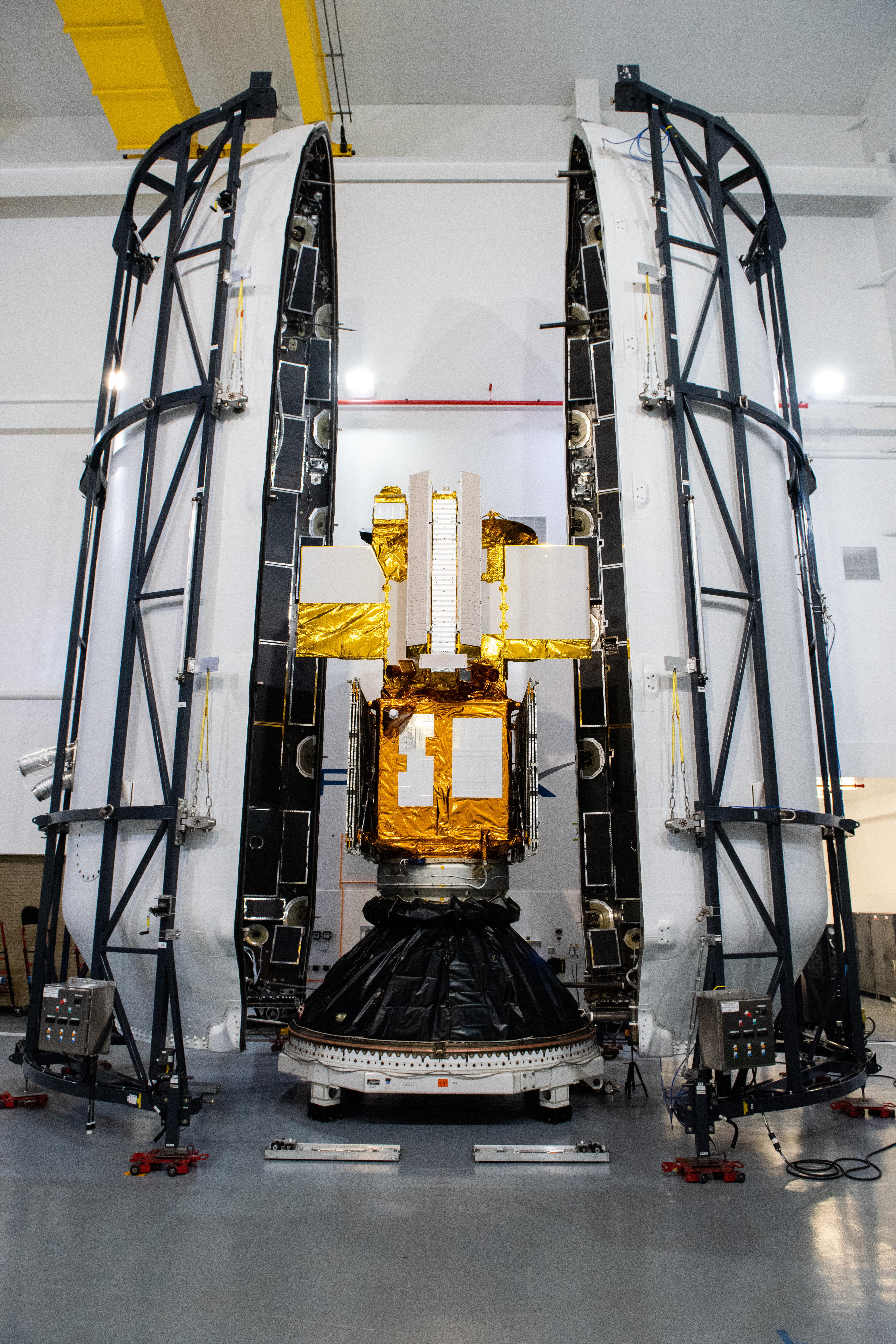
The SWOT satellite, or the Surface Water and Ocean Topography mission, is now encapsulated in its payload fairing in preparation for launch. Technicians at the SpaceX processing facility at Vandenberg Space Force Base in California completed the operation and will soon mate the fairing to the top of a Falcon 9 rocket. The fairing protects the satellite from aerodynamic pressure and heating during ascent. After the rocket escapes Earth’s atmosphere, the fairing separates into two halves, which are jettisoned back to Earth.
Once in orbit, SWOT will measure the height of water in freshwater bodies and the ocean on more than 90% of Earth’s surface. This information will provide insights into how the ocean influences climate change; how a warming world affects lakes, rivers, and reservoirs; and how communities can better prepare for disasters, such as floods.
SWOT is a collaborative effort by NASA and France’s Centre National d’Études Spatiales (CNES) with contributions from the Canadian Space Agency (CSA) and UK Space Agency.
Launch is targeted for Dec. 15, 2022, at 3:46 a.m. PST from Space Launch Complex 4E at Vandenberg Space Force Base.
More About the Mission
SWOT is being jointly developed by NASA and CNES, with contributions from the CSA and the UK Space Agency. JPL, which is managed for NASA by Caltech in Pasadena, California, leads the U.S. component of the project. For the flight system payload, NASA is providing the KaRIn instrument, a GPS science receiver, a laser retroreflector, a two-beam microwave radiometer, and NASA instrument operations. CNES is providing the Doppler Orbitography and Radioposition Integrated by Satellite (DORIS) system, the dual frequency Poseidon altimeter (developed by Thales Alenia Space), the KaRIn radio-frequency subsystem (together with Thales Alenia Space and with support from the UK Space Agency), the satellite platform, and ground control segment. CSA is providing the KaRIn high-power transmitter assembly. NASA is providing the launch vehicle and the agency’s Launch Services Program, based at Kennedy Space Center, is managing the associated launch services.
News Media Contact
Jane J. Lee / Andrew Wang
Jet Propulsion Laboratory, Pasadena, Calif.
818-354-0307 / 626-379-6874
jane.j.lee@jpl.nasa.gov / andrew.wang@jpl.nasa.gov
2022-192