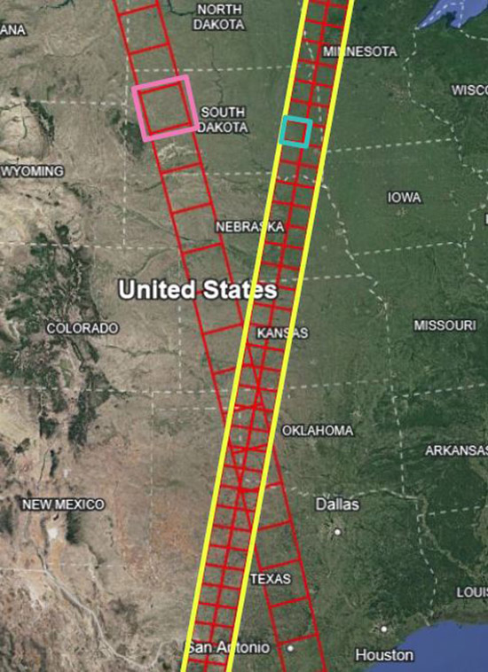
Several data users will want to identify specific times and locations for analyzing SWOT data. SWOT HR data products use Tiles, Scenes, or Continent-level Swaths IDs depending on the product, which define the spatial extent of what is in each file, as follows in the chart below. Along-track scene and tile numbers are numbered sequentially following the spacecraft flight direction, so the numbers increase from south to north for ascending passes and from north to south for descending passes. SWOT LR products use global swaths and nadir tracks that use pass numbers.
Below are a few tools that may be helpful in determining which data to download for the given time and space focus of a particular application or science question.
Map Terms
- Nadir - point on Earth directly below the satellite
- Swath - ground area covered by KaRIn instrument. Watch an animation of how KaRIn will collect data.
- Pass - During its science orbit, SWOT retraces the same path every 21 days, during 292 orbits of the Earth. Each orbit includes an ascending (flying north) and descending (flying south) portion, or "pass". Each pass is numbered (1 to 584). For ascending passes, the time starts near the South Pole. For descending orbits, the time starts near the North Pole.
SWOT Track Visualizer
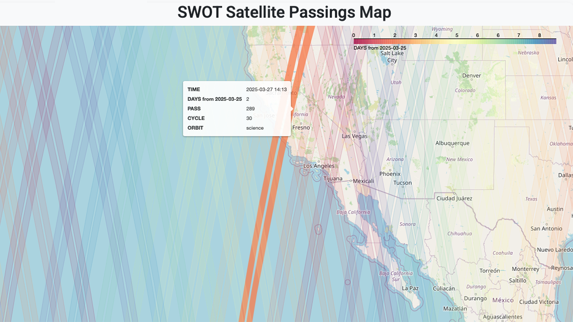
You can figure out where the SWOT satellite was or will be on any given day using the interactive SWOT track visualizer created by iury Simoes-Sousa. By tracking the satellite's passings, users can find when and where SWOT data may be available, making it easier to plan fieldwork, in situ data collection, and analysis.
Search SWOT’s Pass-over Time
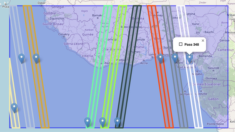
CNES has developed a dedicated visualization tool as a quick look at where SWOT has been, where it is, and where it will be. From within the Binder application, select the area of interest and click the Search button to search for SWOT passes. (Note: the user-provided bounding box needs to be large enough to capture a nadir track. Otherwise, no passes will show up.) The results are displayed in a table and the swaths that intersect the area of interest are displayed on the map. Click on the marker to view the pass number.
SWOT Spatial Coverage

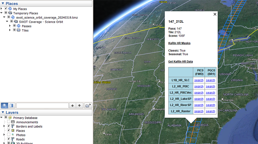
NASA PO.DAAC has created KMZ files that have layers of the SWOT passes and tiles, with corresponding scene numbers identified in the pop-up when a location is selected in Google Earth desktop. Each layer has direct links to Earthdata Search results (the ‘search’ links) for corresponding files. The passes layer has useful information for all SWOT products, but links to the LR products specifically. The tiles layer is useful for HR products (L1B_HR_SLC, L2_HR_PIXC, and L2_HR_PIXCVec products use tile spatial extents while the L2_HR_Raster product uses scenes. L2_HR_RiverSP and L2_HR_LakeSp use continent-level passes).
- Download the KMZ file for the 21-day-repeat science orbit.
- Download the KMZ file for the 1-day-repeat cal/val orbit.
Additional resources can be found in the SWOT Data Resources & Tutorials section of the PO.DAAC cookbook.


